Riding
We have riding for all seasons, including fat-tire riding in the winter, for all levels of riders, and for all types of riding whether you want to ride the mountain bike trails, roads or gravel.
We have three great trail networks that will challenge and excite any rider whether a beginner or an
advanced rider, whether you want to practice skills at the pumptrack or challenge yourself on some
great downhills (and climbs!) and everything in between. And all three networks are accessible for
adaptive riders – how cool is that!
Road Riding
We’re more than happy to help you customize a ride to your level and riding desire ,including adaptive rides –just e-mail us at
tritown.bikefriendlycommunity@
and we’ll be more than happy to work with you.
Our road riding is fantastic and can be geared to any level of rider. Want lots of hills? We’ve got that –
we’re in the White Mountains!
Want a softer ride? Believe it or not we have roads that are flat! Want a
long ride? There are great century rides! Don’t want to ride that much, well you’re in luck as there are plenty of shorter rides. And the routes? They’re all amazing with great views and places to stop, enjoy, or refuel along the way.
Franconia Out and Back – Route 116:
Easier ride: 18 miles for full ride and 700 feet of elevation gain.
For an easier, flatter ride, park at the Franconia Welcome Center and ride route 116 towards Easton. It’s a fairly flat route with beautiful scenery and can be done as an out-and-back so you can ride as much or as little as you want. Shoulders are narrow, but vehicles are used to seeing bikes on the road and generally considerate. And end your ride in Franconia at the Iron Furnace Brewery for a good snack and a refreshing beer!
If you ride out on Route 116 for 9 miles, so an 18 mile out-and-back, total elevation gain is just under 700 feet. There are no big hills – it’s a fairly gentle ride, and pretty fast coming back!
Bethlehem/Carroll out-and-back on Route 302:
Easier ride: 23.6 miles (for full ride) and 1,000 feet of elevation gain.
Another easier, flatter route; park in the parking lot on Route 302 about 5.5 miles outside of downtown Bethlehem (or about 2 miles before Route 3). Ride towards Crawford Notch/North Conway. It’s a pretty good ride from the parking lot to Route 3, and then a wide shoulder on the road from Route 3 all the way to Crawford Notch. It’s also an out-and-back, and scenery is fantastic! Given that it’s an out-and-back, you can ride as long or short as you want. And stop at Drummonds Mountain Shop along the way for great gear, snacks and support! Be warned – there is a VERY DANGEROUS railroad track crossing a little past Drummond’s Mountain Shop – do not ride over them – walk your bike across. The angle of tracks to the road is extremely steep making it very dangerous and not rideable. We are working intensely with the DOT to fix this, but until we do, walk your bike across.
If you ride from the parking lot, all the way to the Highland Center, it’s 11.8 miles to the Center, or 23.6 out-and back with total elevation gain of just over 1,000 feet. There are no big hills, and the ride back is fantastic!
Littleton Lollipop
Easy to moderate ride: 17.4 miles and 1,000 feet of elevation gain.
Park in Littleton, there’s lots of free parking in and around Town. Head out on Route 116 towards Whitefield. It’s a busy road but there’s a pretty good shoulder and drivers are usually considerate, and there are great mountain views as you head out. We like to stay on Route 116 until you get to Route 142 at the top of the hill and then turn right. Stay on 142 until you get to Wing Road, about 2.5 miles and turn right. Route 142 is rolling hills and not a big shoulder, but cars are used to riders on the road and are considerate, At the end of Wind Road – a fairly quiet and scenic road along the river, you’ll be back at Route 116. Turn left and head back to Littleton.
The total mileage is about 19 miles with elevation gain of about 1,000 feet. The biggest hill is after you pass Wing Road on Route 116 coming up to the turn onto Route 142. It’s about a 6-7% grade, but isn’t that long. A nice easy gear and spinning gently will get you through it.
The Bethlehem/Littleton/Whitefield Figure 8:
Easy to moderate ride: 17.5 miles and 1,100 feet of elevation gain.
You can really park anywhere along the route, but two good options are in the center of Bethlehem, or at the bottom of Elm Street in Bethlehem by the ball fields. This will leave you at Rek-Lis, Maia Papaya or Super Secret at the end of your ride and you can grab a cold beer, good coffee and food, or some delicious ice-cream (or all of them!). You can also park at the Wayside Inn and finish with a cold drink and good snack or meal.
Enough about the food and drinks – let’s talk about the route: Starting in Bethlehem head out on Route 302 towards Twin Mountain. There are pretty good shoulders as you get out of Town, but be very careful going over the bridge right after Trudeau Road. There was an issue when the expansion joints were installed and they’re working to replace them. Right after the bridge take your first left onto Beech Hill Road and an immediate left onto River Road. Follow River Road and cross over the intersection of Route 142 and continue straight onto Wing Road. Both of these roads are fairly quiet and scenic as they follow the river. At the end of Wing Road, turn right onto Route 116 and follow it to the top of the hill where you’ll see Route 142. Turn right. Route 116 has faster traffic, but really good shoulders and Route 142 is narrower, but slower and generally quite considerate traffic. Follow Route 142 back to the intersection of Wing and River Roads and go left on River Road, At this point you’ll just retrace your steps back to Bethlehem – River Road to Beech Hill Road, turn right, then an immediate right onto Route 302 back to Bethlehem. See previous paragraph – stop for beer, food, coffee, ice cream, Enjoy!
The total loop is about 17.5 miles and 1,100 feet of elevation gain. There are two hills, one is after you pass Wing Road on Route 116 coming up to the turn onto Route 142. It’s about a 6-7% grade, but isn’t that long. The second is on Route 302 on your return as you’re coming back into Bethlehem (it’s just after the Wayside Inn). It’s a steady 1 mile climb, but grades are about 6% so it’s not too bad. Use a nice easy gear and spin through it.
Littleton/Bethlehem Loop:
Moderate ride: 18.5 miles and 1,250 feet of elevation gain.
Lots of good parking options for this ride too – see the Figure 8 and the Lollipop loop for suggestions.
I’ll assume you’re starting from Bethlehem, but if it’s Littleton, you can pick up the route directions later on and go from there. Starting in Bethlehem head out on Route 302 towards Twin Mountain. There are pretty good shoulders as you get out of Town, but be very careful going over the bridge right after Trudeau Road. There was an issue when the expansion joints were installed and they’re working to replace them. Right after the bridge take your first left onto Beech Hill Road and an immediate left onto River Road. Follow River Road and cross over the intersection of Route 142 and continue straight onto Wing Road (you can extend the ride a bit if you turn right onto Route 142 and follow it until you reach Route 116 where you’ll turn left). Both of these roads are fairly quiet and scenic as they follow the river. At the end of Wing Road, go left onto Route 116 and follow it towards Littleton. You can either go left on Redington Street (by the Naults Powersports Store) and follow that up Brook Road until you get to Route 302 where you’ll turn left. It’s a quieter road and you go by some farms, but the hill is steep at the end. Or you can continue straight into Littleton until you get to the traffic light at the center of Town. Route 116 generally has good shoulders and is a good road to ride. At the traffic light, turn left onto Route 302 and follow it all the way back to Bethlehem. It’s a long and fairly steady climb, but not a killer climb. The steepest part is coming out of Littleton.
If you do the full loop, and don’t turn and go up Redington Street or up Route 142, the route is about 18.5 miles and 1,250 feet of elevation gain. See description for summary of the hills.
Bethlehem/Twin/Trudeau Loop:
Moderate ride: 18.7 miles and 1,100 feet of elevation gain.
This tends to be a little faster of a route, but the Route 3 section is not for those who are not comfortable riding with cars, and honestly, we don’t recommend riding it on Friday, Saturday or Sunday during busy season given the number of cars and campers on the road.
That said, it’s a fun route. For parking, two good options are in the center of Bethlehem, or at the bottom of Elm Street in Bethlehem by the ball fields. This will leave you at Rek-Lis, Maia Papaya or Super Secret at the end of your ride and you can grab a cold beer, good coffee and food, or some delicious ice-cream. You can also park at the Wayside Inn and finish with a cold drink and good snack or meal. Or you can make it a longer ride and park in Littleton and ride Route 302 into Bethlehem and follow the rest of the route from there. That will add about 11 miles to the route, but leaves you at the bike store and Crumb Bum Bakery at the end – bike gear coffee and pastry, who doesn’t like that?
Otherwise, head out on Route 302 towards Twin Mountain. Route 302 has good shoulders heading out this way and some fantastic views! Follow Route 302 until you get to Route 3 in Twin Mountain and then turn right on Route 3. When heading out of Bethlehem and you go down the Maplewood Hill, be careful after you pass Trudeau Road. The expansion joints in the bridge were built incorrectly and can be very dangerous to cross. Soon after the bridge, you’ll climb a short, 7% grade hill – it’s not bad, just use a nice easy gear. Back to Route 3: there are generally good shoulders, but be careful on this road as it can be busy, especially during busy season and on a Friday, Saturday or Sunday. Follow Route 3 until you get to Trudeau Road in Bethlehem and turn right. Follow Trudeau Road to the end (only a couple miles) and go left on Route 302. You’ll climb a hill soon after you get onto Route 302 which is about 1 mile long but not an overly steep climb – probably a 6% grade. This will take you back to Bethlehem where you will have earned that beer, coffee, ice cream and some food!
The full ride is 18.7 miles long and about 1,100 feet of elevation gain.
Bethehem/Franconia/Cannon Mountain/Littleton Loop:
Moderate ride: 24.2 miles and 2,000 feet of elevation gain.
This is a little bit of a longer route and there are lots of good options along the way. There are also some great views!
For parking, two good options are in the center of Bethlehem, or at the bottom of Elm Street in Bethlehem by the ball fields. This will leave you at Rek-Lis, Maia Papaya or Super Secret at the end of your ride and you can grab a cold beer, good coffee and food, or some delicious ice-cream. You can also park at the Wayside Inn and finish with a cold drink and good snack or meal. You can also park at Iron Furnace in Franconia and then you get to end there (see previous comments on food and beer!).
Or you can make it a longer ride and park at Littleton Bike and Fitness in Littleton and ride Route 302 into Bethlehem and follow the rest of the route from there. That will add about 11 miles to the route, but leaves you at the bike store and Crumb Bum Bakery at the end!
Okay, the route. I’m going to start it from Bethlehem but you can jump in anywhere along the route or make it longer by starting in Littleton. This is a really pretty route, but the Route 3 section is not for those who are not comfortable riding with cars, and honestly, we don’t recommend riding it on Friday, Saturday or Sunday during busy season given the number of cars and campers on the road.
Head out on Route 302 towards Twin Mountain. Route 302 has good shoulders heading out this way and some fantastic views! Follow Route 302 until you get to Route 3 in Twin Mountain and then turn right on Route 3. There are generally good shoulders, but be careful on this road. You’ll follow this all the way out towards Route 93 (please do not get on Route 93!); you can either go right onto Route 141 which is a fast downhill, or you can get on the Franconia Bike Path on the left side of the road (careful crossing Route 3) soon after the Route 141 turnoff and take that till you can go right over Route 93, and that will take you to Route 18, or Profile Road and go past Cannon Mountain to a nice downhill here too. Either option will take you to the same place and you’ll end up following Route 18 through Franconia and then all the way into Bethlehem where you’ll meet Route 302 again. Go right and follow it back into Town. On 302 as you head into Bethlehem you’ll climb long hill. It’s about a 1 mile climb at about a 6% grade – the first section is a little steeper, probably 7% but it’s a nice steady climb.
As another option, as you come into Franconia, you can go right on Route 142 and go up and over Agassiz. It’s about a 5 mile climb, and about 750 feet in elevation with the steepest section right at the beginning. The rest is a nice ride and climb and then you get a fantastic 1 mile 11% grade downhill straight into Bethlehem!
The basic loop is about 24.2 miles with a little over 2,000 feet of elevation gain
Sugar Hill Loop:
Advanced ride: 23.8 miles and 1,700 feet of elevation gain.
This is always a favorite ride as the views are fantastic! Lots of places to park for this one. You can park at Littleton Bike and Fitness (think bike shop and Crumb Bum Bakery at the end), Iron Furnace Brewery in Franconia (think beer and food at the end), or at Polly’s Pancake Parlor (think great pancakes and views).
I’ll start the ride assuming you park in Littleton. Head out on Route 302 towards Bethlehem – you’ll have a couple miles of climbing coming out of Littleton with the steepest part in the beginning. When you cross over Route 93, right after the final ramp merges, turn right onto Route 18/Profile Road and follow it into Franconia. As you pass Iron Furnace Brewery on the left, there’s a turn on the right – Route 117. Follow it up towards Sugar Hill – it’s about a 3 mile climb and the steepest section is in the beginning. There are some fantastic views along the climb – they’re so great you won’t even notice that you’re climbing! And when the climb is done you get an amazing 5 mile downhill (be careful – some sharp turns) all the way to Route 302 where you’ll turn right and follow it back into Littleton. You can stay right on Route 302 into Littleton if you’re comfortable riding with cars. Be careful along this stretch – cars are fairly considerate but the shoulder goes in and out and then Littleton gets quite busy as you get into Town. Or you can turn right onto Streeter Pond Road and soon after you cross the bridge, follow the road left, onto Mt. Eustis Road. This will take you to Industrial Park Road (you’ll go left off Mt Eustus Road, and follow that into Littleton where you can either stay on the road, jump on the rail trail, or jump on the bike path. Depending on the type of bike you’re on, you can also jump on the rail trail right after you turn onto Streeter Pond Road (after crossing the bridge) and it’ll take you right into Littleton along the river. It’s a beautiful, and great ride though!
23.8 miles and 1,700 feet of elevation gain.
Littleton/Whitefield/Twin Mountain/Bethlehem Loop:
Advanced ride: 32.5 miles and elevation gain of about 2,300 feet.
This is a great loop that has lots of options along the way and some fantastic views. There are also a few tricky spots on the road that I’ll point out.
You can start this route from Bethlehem or Littleton and park at any of the great locations in either Town: Bethlehem, park in Town, by the basketball courts, by the pool, or by the ballfields at the end of Elm Street. In Littleton you can park at any of their free lots in Town or on the street as well. And this lets you end at some great places like Littleton Bike and Fitness, Crumb Bum Bakery, Rek-Lis Brewery, Super Secret Ice Cream or Maia Papaya (read: bike gear, coffee, beer, ice cream and snacks).
From Bethlehem, if you want a shorter version of the route, head out on Route 142 towards Whitefield and follow it all the way until you reach Route 116 where you’ll turn right.
If you want a longer route, head out on Route 302 heading towards Littleton and go right into Littleton until you reach the traffic lights where you’ll turn right onto Route 116.
If starting in Littleton, head out on Route 116 towards Whitefield.
Route 116 has some big shoulders and great views along the way, so it’s a pretty good road to ride. You’ll follow this road all the way into Whitefield where Route 116 intersects with Route 3 – turn right onto Route 3.
Note that as you start out on Route 3 there are some railroad track crossings to be aware of, and as you climb the hill the road gets narrow and curvy for a short period – be very careful through here – it’s one of my least favorite sections of road in the area, but the reward at the top is worth as the views are fantastic!
Follow Route 3 all the way into Twin Mountain/Carroll – and again, as you get close to Twin Mountain be careful of the railroad crossings. We recommend walking across them.
When you get to the traffic lights in Twin Mountain you can turn right onto Route 302 and follow it all the way back to Bethlehem (or Littleton).
You can also keep going straight on Route 3 through the intersection and turn right onto Trudeau Road that will take you back to Route 302.
Or you can really extend the ride and keep going straight on Route 3 into Franconia. There are generally good shoulders, but be careful on this road. You’ll follow this all the way out towards Route 93 (please do not get on Route 93!); you can either go right onto Route 141 which is a fast downhill, or you can get on the Franconia Bike Path on the left side of the road )careful crossing Route 3) soon after the Route 141 turnoff and take that till you can go right over Route 93, and that will take you to Route 18, or Profile Road and go past Cannon Mountain. Either option will take you to the same place and you’ll end up following Route 18 through Franconia and then all the way into Bethlehem where you’ll meet Route 302 again. Go right and follow it back into Town.
As another option, as you come into Franconia, you can go right on Route 142 and go up and over Agassiz. It’s about a 5 mile climb, and about 750 feet in elevation with the steepest section right at the beginning. The rest is a nice ride and climb and then you get a fantastic 1 mile, 11% grade downhill straight into Bethlehem!
The loop, if you just do the basic loop, is about 32.5 miles with an elevation gain of about 2,300′.
North Conway Out-and-Back:
Advanced ride: 85.5 miles and 5,300 feet of elevation gain.
This is a longer, out and back ride, but has lots of great views and can be done as a full day activity, or a nice, long ride. Or you can ride to North Conway and have someone meet you there, refuel, and get a ride back.
You can also start this ride from any of the Towns, but distances and elevations will be from downtown Bethlehem.
From Littleton, you can either head east on Route 302 and go right into Bethlehem, and follow the road from there, which will add about 5.5 miles each way and about 800 feet of elevation. Or you can go the long way and take Route 116 towards Whitefield, head all the way into Whitefield (careful of the railroad track crossings coming into and out of Whitefield center). When you get to Whitefield center, turn right onto Route 3 and follow it all the way to Twin Mountain/Carroll. Again, be careful of some bad railroad crossings as you get close to Twin Mountain – you should probably be prepared to walk across them. Also, coming out of Whitefield Center on Route 3, be very careful as you start to climb the hill as the road is narrow, windy, and without a shoulder – it’s a short distance, but be careful. Once you get past that section there are some fantastic views! When you reach Twin Mountain, turn left onto Route 302.
From Franconia Center, you can climb Route 142 and go over Agassiz into Bethlehem. This will add about 5.5 miles each way and about 800 feet of climbing. Once in Bethlehem turn right onto Route 302. Or, you can head out of Town toward Cannon Mountain on Route 116/18 and follow it until you get to Route 141. Climb Route 141 until you get to Route 3, and follow Route 3 into Twin Mountain/Carroll, and when you get to Route 302, turn right. Note that Route 3 is not our favorite road on a busy day – we tend to avoid it on Friday, Saturday and Sundays during busy season.
Once everyone is on Route 302 heading east, follow it all the way into North Conway. It’s a great ride out there – a little harder coming back. Views are great, shoulders and roads are pretty good too. Just be very careful after you pass Twin Mountain/Route 3 and you go past Drummond’s Mountain Shop, soon after there are some very dangerous railroad tracks that cross at a very steep angle to the road. You should walk your bike across these tracks.
If you do the whole out and back from Bethlehem, it’s about 85.5 miles and 5,300′ of elevation gain. The elevation gain is not evenly split, so if you do it heading from Bethlehem to North Conway, it’s only 42.75 miles and 2,200 feet of more gentle climbing.
Gravel Riding

We’re more than happy to help you customize a ride to your level and riding desire ,including adaptive rides –just e-mail us at
tritown.bikefriendlycommunity@
and we’ll be more than happy to work with you.
If you’re looking to get off the roads and ride some of the quieter gravel roads you’re coming to the right
place. We have miles and miles of unpaved roads that are great for riding, and like everything around
here, there are great views along the way!
Here are some mixed terrain routes to get you started. These routes tend to be for intermediate and advanced riders; not as much for beginners. Many of the roads switch from paved to dirt, and at times, paths. We’ve included a link to Map My Ride for the routes but please note that there are certain places on the map where paths don’t show up, so it may not appear connected on the map, the written directions below explain the route. Please obey all traffic and safety rules and wear a helmet.
Littleton: Mann’s Hill to Forest Lake Loop
20.6 miles with about 2,150 feet of elevation gain >> Map My Ride Route Link
Start in Littleton center (this let’s you finish here too and get a great coffee and pastry at Crumb Bum, or grab some gear for the next ride at Littleton Bike and Fitness).
Head up Pleasant Street, which turns into Mann’s Hill Road. At about 4.5 miles Mann’s Hill Road turns right (if you go straight it will continue onto Misery Road – you don’t want that). In less than 2 miles from this point, turn right on Miller Road. Follow Miller Road for a little bit and at about mile 8 of the ride go right onto Mountain Road and follow it until it intersects with Faraway Road. Go right. A short time later you’ll go left onto Forest Lake Road. Stop at Forest Lake and take a dip – it’s a great lake to cool off! Forest Lake Road comes out on Route 116 – go right and follow it back to Littleton. It’s about 9 miles. If you don’t want to ride the road all the way back, when you get to OxBow Road, go left and you can get on the railtrail and ride it back along the river – it’s a really nice ride this way. This route has some great views, great places to stop, can be challenging in spots (but not too bad) and some good road riding back – truly a mixed terrain route!
Littleton: Slater Ledge to Partridge Lake Loop
27.7 miles with about 2,700 feet of elevation gain >> Map My Ride Route Link
Start in Littleton center (this let’s you finish here too and get a great coffee and pastry at Crumb Bum, or grab some gear for the next ride at Littleton Bike and Fitness).
Head through Town (away from Whitefield and Bethlehem) and follow Main Street/Route 302 until it splits at the Beal House – stay right onto Route 18/135. Follow this past the overpass and up the hill and turn left staying on Route 18/135 towards the Hospital. As you get close to the hospital turn left onto Slater Ledge Road which turns into Logging Road. This will eventually (about 3 miles) come out onto Route 302 (careful of traffic along here) – go right for about 2 miles and turn right onto Lyman Road. Stay on Lyman Road for about 4 miles where you’ll eventually go right onto Organtz Road. In less than 2 miles, you’ll come to a “T” in the road – go right here. You’ll be on Hurd Hill Road, which will turn into Hubbard Road and then Partridge Lake Road. You can take a diversion in here and ride around Partridge Lake – it’s a beautiful and a great place to take a dip and cool off. Partridge Lake Road will eventually come out onto Route 135. If you go left, you can go down to Moore Dam, another great place to take a dip. Otherwise, go right and head back towards Littleton. At the end of the road, go right again and it will bring you right back into Town. This is another route with some beautiful spots along the way and for the most part, off the beaten path.
Bethlehem: Wing Road/River Road to Trudeau Road/Swazey Lane Loop
14.7 miles with about 1,000 feet of elevation gain >> Map My Ride Route Link
Park in the center of Bethlehem. Here you have the advantage of finishing your ride with an ice cream at Super Secret, then a beer at Rek-Lis, and then a coffee at Maia Papaya – does it get any better?!
Head out on Main Street towards Littleton and turn right onto Prospect Street. Follow this nice long downhill until you cross the narrow bridge where you’ll turn right onto Wing Road. Follow Wing Road across Route 142 where it then becomes River Road. Both Roads have some great places to stop and cool off along the river and enjoy some great views. At the end of River Road take a right onto Beech Hill Road and then a quick right onto Route 302. Follow this across the bridge (being super careful of the expansion joints that were built incorrectly and will eat up a bicycle tire in a quick second – they are planning to fix it). Soon after take a left onto Trudeau Road which you’ll follow for about 2 miles where you’ll turn right onto Swazey Lane. Follow Swazey Lane for about 2 miles where it will rejoin Route 302. Turn left and follow it back into Town.
Bethlehem: Lewis Hill Road, South Road, Cherry Valley loop
17.0 miles with about 1,750 feet of elevation gain >> Map My Ride Route Link
Park in the center of Bethlehem. Here you have the advantage of finishing your ride with an ice cream at Super Secret, then a beer at Rek-Lis, and then a coffee at Maia Papaya – does it get any better?!
Head out on Main Street/Route 302 towards Littleton. Before going down the hill, you’ll turn left onto Lewis Hill Road which you’ll follow until it comes out on Route 142, Agassiz Street. Go right towards Franconia. Right before you get into Franconia, and before you go under the overpass, turn right onto Lafayette Drive. Follow this for about 1 mile and turn right onto Wallace Hill Road. Follow Wallace Hill Road (don’t go left at Skyline – stay right) and you’ll take a left at what seems to be a “T” in the road. This is where the road turns into South Road. Follow it to Parker which is almost at your 11 mile marker, and go left onto Parker. It’s a short road, and at the end, turn left onto Route 302. Follow Route 302 for a short bit and turn right onto Cherry Valley Road. Follow this to the end where you’ll go right onto Prospect Street. There are some gorgeous views as you turn here, and if you go left and follow Prospect Street left, it’ll take you down to the river where you can cool off a bit. Either way, follow Prospect Street right (back track if you were at the river) and it will come out on Main Street/Route 302. Turn left and follow it back into Town.
Franconia: Mt. Eustis Road Loop
23.25 miles with about 2,150 feet of elevation gain >> Map My Ride Route Link
Park at the Visitors Center in Franconia – when you’re done you’ll be right next to the Iron Furnace Brewery for a cold beer and snack, or if it’s an early morning ride, run up to Polly’s for a great breakfast. And if you need gear for your next ride – stop in at Franconia Basecamp or White Mountain Bikes.
Coming out of the Visitor’s Center parking lot, go right heading through Town. At Route 117 turn left and follow this up until you get to your second right, which is Lover’s Lane. There are some fantastic views along the way, so enjoy! Lover’s Lane turns into Grandview Road which turns into Center District Hill Road. Follow this to Jessman Road which then turns into Crane Hill Road. Take this into Streeter Pond Road. You can turn right here and follow it back into Town, about 2 miles of easy riding with great views, or you can go left on Streeter Pond Road and follow it to Mt Eustis Road. Follow this to the end, which is around mile 20 of your ride, and turn right onto Eustis Hill Road. Follow Eustis Hill Road to Cyr Road (it’s less than 1 mile). Cyr turns into Lehan Road which you’ll follow until it hits Old Franconia Road – also a beautiful road to ride and a good spring along the way where you can get water. Turn right onto Old Franconia Road which will take you back to Route 18 and a quick ride back into Franconia. Stop at the river or Coffin Pond to cool off as you relax at the end of a great ride!
Franconia: Pearl Lake Loop
27.4 miles with about 2,800 feet of elevation gain >> Map My Ride Route Link
Park at the Visitors Center in Franconia – when you’re done you’ll be right next to the Iron Furnace Brewery for a cold beer and snack, or if it’s an early morning ride, run up to Polly’s for a great breakfast. And if you need gear for your next ride – stop in at Franconia Basecamp or White Mountain Bikes.
Coming out of the Visitor’s Center parking go right, and then your first left onto Route 116 at the stop sign. After about 1 mile, take a right onto Bickford Hill Road and then a quick left onto Ridge Road. At a little over 2 miles into the ride you’ll take a right onto Lafayette Road. Follow Lafayette until you get to Todd Hill Road and go left – this will eventually turn into Dyke Road. Dyke Road will eventually meet with Jim Noyes Hill Road – soon after turn right onto Pearl Lake Road and follow it around Pearl Lake (and enjoy some of the great views!). You’ll follow this around for about 6 miles and then turn left on Creamy Pond Road which, with a slight left turn, you’ll end up getting onto Route 117 for a short stint and then you’ll go right onto Center District Road. You’ll only be on Center District Road briefly and you’ll take a right onto Grandview Road, which becomes Lover’s Lane. Lots of great views through this area too – be sure to enjoy them! Lover’s Lane will take you back to Route 117. Turn right onto 117 where you’ll be on it for a short period of time until you turn left onto Bickford Hill Road. This will take you back to Route 116 where you’ll go left and then head back to the Visitor’s Center.
Fat Tire Riding
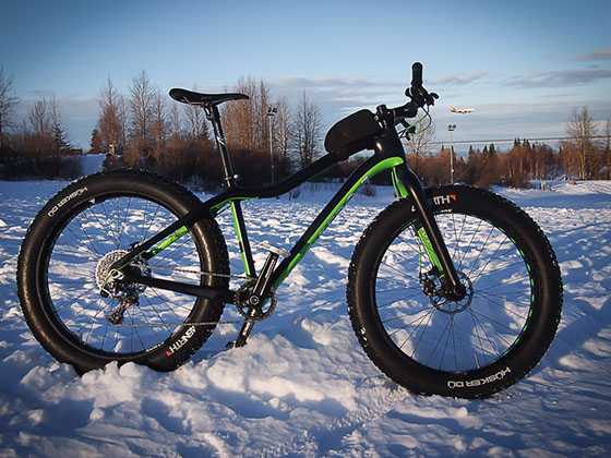
Across the three trail networks we groom almost 50 miles of trails for fat tire riding. Always check the networks for current conditions, but be sure to try them out. Fat tire riding, as one rider likes to say, “is like cheating nature.” It’s an amazing experience! If you’re new to mountain bike riding this is a great way to get started as the trails are smoothed over with the snow. And if you really want an amazing adventure, go fat tire riding at night – it’s magical and you’re almost certain to run into a few others having a great time too! But be sure to have the right lights.
Adaptive Sports Partners

And of course, if you have adaptive cycling needs, you are absolutely coming to the right place. Our
trails, roads, and gravel roads are fantastic for adaptive riding, and our partners at Adaptive Sports of
the North Country https://adaptivesportspartners.org/ will work with you to get you on a bike if you
need one, provide instructors and training if needed, or work with you in any way to get you on a bike
and enjoying the majestic White Mountains and North Country!
"Bethlehem Trails is a diverse network with something for everyone. My favorite route is to climb to the summit of Mt. Agassiz and descend all the way to the Ammonoosuc River.”
Kelly M“I’ve enjoyed many on-trail conversations with visitors to the area who were just out and about enjoying the views and variety of challenges presented by the terrain.”
Dan Cthese are the best trails in the Northeast; there’s something for everyone and they’re fun, flowy and great to ride”
Tony Q“I love being able to have such a great choice of trails to ride year round – there’s so much to discover, and at the end be right in Town for a coffee, pastry or beer”
Bruce C“It's more than a bike trail, it's an adventure! Rail trails, dirt roads, bike paths and quiet back roads link together an adventurous bike route from Woodsville, New Hampshire to Bethel, Maine traveling through the amazing Towns of Littleton and Bethlehem along the way. On the Cross New Hampshire Adventure Trail, cyclists of all ages can experience the glory of the northern New Hampshire landscape, learn about the natural and cultural history of the region and partake in the hospitality of the many small towns along the way.”
Bob H“The road riding in the Tri-Town region is amazing. Great routes – challenging or easy, but all with great views along the way, great support if you need it, and great places to stop and refuel or end with a great beer. It’s fantastic!”
Rick J“Three great but distinctly different trail systems within 10 minutes of each other for some great mountain biking and a coffee shop and brewery near each one.”
Dave H“I love the wide variety of mountain biking trails that are fun for beginners and experts alike. As an experienced rider, there are plenty of harder trails to challenge me. I also enjoy swinging by the Franconia Inn after a long ride for a cold drink and a bite to eat!”
Andrew We are spoiled to live in the white mountains. Being able to ride out my front door to do a gravel ride on stone walled lined dirt roads throughout the area or a ride through the notches on my road bike, other days I grab my mountain bike and ride some of the technical terrain in the White Mountain National Forest. This is the privilege of living where we do.
Tim C
It's an incredible feeling of freedom to be able to bike from my house in downtown Littleton to access a network of mountain bike trails (PRKR) with beautiful forest and clear signage. We also have easy access to the rail trail and river walk in town. We feel very lucky to live here."
Angela